Tom's Journal - August 2 - August 8
The Top of the World
Well, I'm impressed! Yesterday evening, three bicyclists arrived and set up camp in a spot directly behind us. I talked with them to see how far they were going. On July 1st, they left Prudo Bay Alaska (the northern end of the Alaska Pipeline) on the only road that runs from the north of Alaska. They are riding to Argentina (no fooling). They have to take a boat in Panama for a short ways and some boats out to a few islands but otherwise they are riding the entire way. They also told me about another Japanese cyclist they just met that rode in last night and had the site right next to theirs. He has been cycling around the world for the past three years and is on his final leg and riding to Argentina. I found him over by the pavilion getting ready to take off so I talked with him for a few minutes. Yes, he has been riding around the world for the past three years. He has been touring around Alaska this summer and he is riding down to Argentina. His plan is to make it down there over the next two years. He was heading towards the Canadian border today (97 miles) but it might take him two days to get there as he was getting a late start. He said he rides about 60-70 miles in a day (if it is mostly flat). Okay, I now know what I am doing with my summer vacation next year!
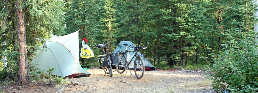 Bicyclist camp: they are on their way to Argentina! |
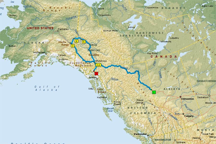
We're no sissies!!! Only sissies take the Alaska Highway. Real explorers take the Taylor Highway and the Klondike Loop, including the Top of the World Highway, from Tok to Whitehorse and pass through Chicken and Dawson City. This route includes a rough dirt road from just before Chicken all the way to the US-Canadian border and then improves a little into a rough gravel road from the border to Dawson City before returning to a two lane highway to Whitehorse. On the following map, the Alaska Highway is shown by the line from 1-Dawson Creek, 2-Whitehorse, to 3-Tok. The Taylor Highway and Klondike Loop is shown by the line from 3-Tok, 4-Chicken, 5-Dawson City, to 6-Whitehorse where it rejoins the Alaska Highway. However, from Whitehorse we intend to head to 7-Skagway Alaska.
You may be asking "when is this madness going to end." Well, we still have several more stops planned and we are intending to be home in three weeks, around August 31st. Thanks everyone for keeping up with our travels and the encouragements.
Day 56 (Sunday, August 2)
Still in Tok, we attend a friendly Faith Chapel Church in the morning and finished our shopping and planning in the afternoon. Tomorrow we head out.
Day 57 (Monday, August 3)
We headed out at 11:30 for the 80 miles from Tok to Chicken Alaska. There is supposed to be beautiful views of the surrounding mountains and valleys but due to fires in the area, everything is hazed over in smoke and we had no views. I guess some years it is socked in with rain clouds and, if it isn't raining, there are fires and smoke. There are numerous wildfires every year caused mostly by lightning strikes. These natural fires are allowed to burn, therefore smoky days are somewhat normal.
We drove through the remains of a large fire from 2004 that had threatened Tok. We saw the remnants of the burned trees with the underbrush coming back. We got to see how fireweed (the pretty pink flowers we see along the roadway) got its name. It is one of the first plants to reestablish after a fire. It was rather interesting to see the burned out forest with the a pink cast from all of the fireweed growing back.
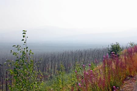 Remnants of 2004 fire |
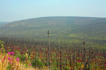 Fire remnants showing fireweed filling in |
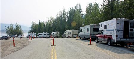
In Chicken, there is a gas station that offers one free night of dry camping if you fill up there. I couldn't resist such a bargain. Even though I filled up in Tok, I topped off in Chicken to get the free night. The dry camp area is a big open area nearby and only one other RV spent the night there.
It was dusty and smoky with no views of the hills or valleys. We drove around Chicken and saw the sights, main street Chicken, the old dredge, and the gift shops. We also drove out to the post office and talked with the postmaster. The town only has about 15-20 residents during winter and only about 60-70 during the summer.
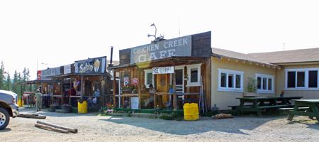 Main Street Chicken: Mercantile, Saloon, and Cafe |
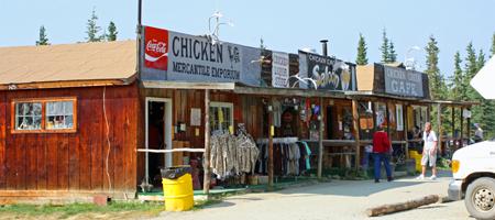 I had to walk all the way across town to get this second view of Main Street Chicken |
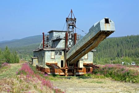 The dredge: we saw interesting pictures showing its move to here |
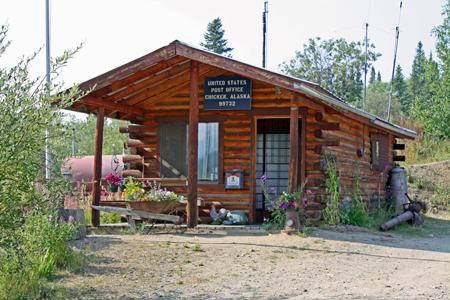 The post office in Chicken. We had a good chat with the postmaster |
Day 58 (Tuesday, August 4)
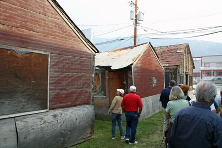
Before heading on our way to Dawson City, we took a guided tour of the original town of Chicken, a very interesting tour. Chicken was another gold mining town. In the early 1900's, it swelled to around 600 people as a mining company town that supported a dredge and all of the support personnel.
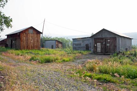 Part of old town Chicken, a gold dredge mining town |
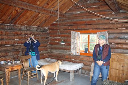 A large one room cabin: can you imagine living in a small one room cabin like this? I can, we have been doing it for a couple of months now. |
Okay, beginning just before Chicken, the highway turned into a rough dirt road. We slowly made our way bouncing along on the road in the dirty, eerie, smoky haze. The smoke and dirt road made for a tiring drive. The Top of the World is truly on fire! Things held up fine until we stopped just before the border and found the glass plate from the bottom of the microwave had broken and crashed all over the inside of the trailer. Not very pleasant but we will survive.
We crossed the border without incident and continued our way to Dawson on the gravel road. Now, there happened to be a river, the Yukon, between us and the town of Dawson. There is no bridge to cross the river on this road to Dawson. However, there is a ferry. We waited an hour and twenty minutes for our turn to cross the river on the ferry, all the time with the town of Dawson in sight.
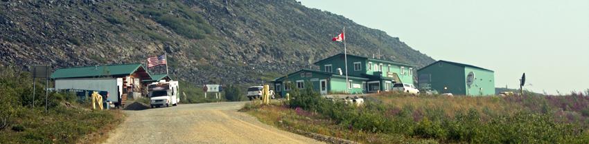 The remote US and Canadian border. It is only open from 9 AM to 9 PM. |
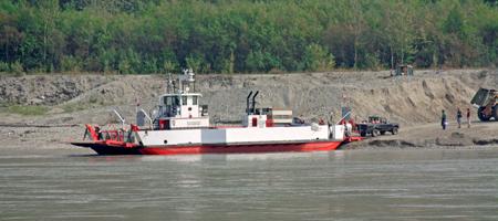 The Yukon River ferry into Dawson |
 Our wait in line for our turn on the ferry |
We pulled into Bonanza Gold RV Park with gravel and dirt sites (not uncommon for an RV park) and very gloomy smoky hills. The breezy, dusty, smoky environment was somewhat depressing but it is home for three nights. While setting up, I found that I had lost our sewer cap and had a crack in the gray water sewer line that was dripping. For now, I put a bucket under the drip.
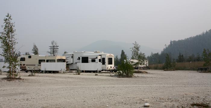
Our dusty gravel RV park in Dawson
Day 59 (Wednesday, August 5)
After a night's rest, things looked a little better and we were feeling better about Dawson, a little less smoke and the breeze and dust settled down some. We drove into town for an afternoon of exploring. Dawson is a large little town with a great deal of history and character.
We saw a short cute play called "Buckshot and Bloomers" at the Palace Grand Theatre that gave a true depiction of the life of saloon girls in a boom town, not so glamorous.
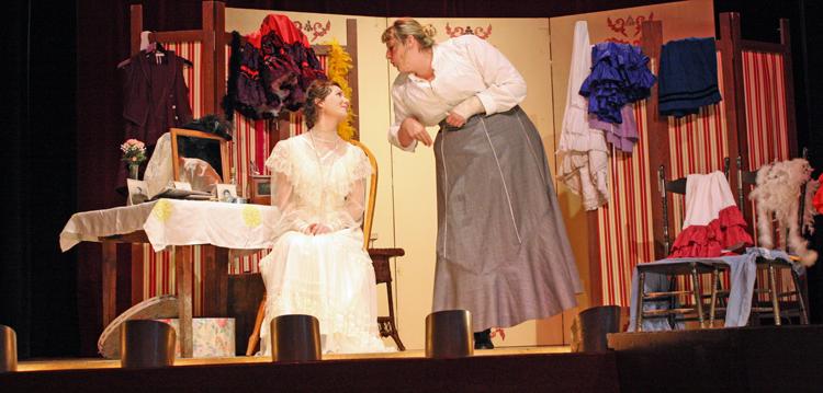 Buckshot and Bloomers, a tale about saloon girls in Dawson |
We then took a very informative guided walking tour of Dawson with several sights and a lot of historical background. It gave us a good sense of the harsh environment along with negative 40 degree and below winters. However, the town back then was kept in good check by a large contingent of Canadian Mounted Police.
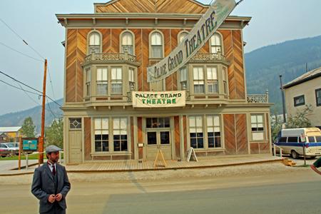 The Palace Grand Theatre with our street tour guide |
 The red light district from old Dawson |
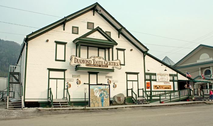
After dinner, we headed back to Dawson on date night to Diamond Tooth Gertie's for the nightly floorshow; a must see while in Dawson.
|
Oh, by the way, I did get some emergency black plumbing tape from the hardware store and sealed the leak on the sewer pipe and I had a spare sewer cap.
Day 60 (Thursday, August 6)
We continued our exploring of Dawson with a drive down the Bonanza Creek where gold was discovered in 1896 and a tour of Gold Dredge Number 4. The tour provided an interesting overview and background on how the dredge worked.
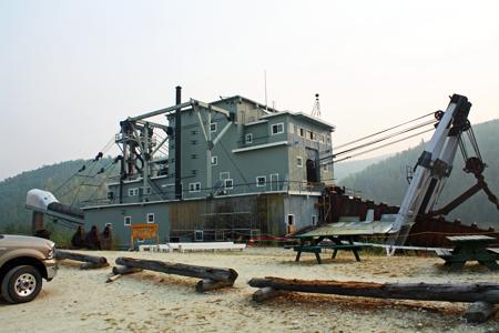 Dredge Number 4 |
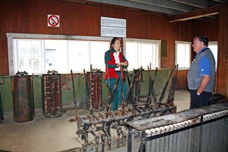 The control room and our guide inside Dredge Number 4 |
Well, the wind, dust, and smoke returned in the afternoon to make our drive up Dome Hill, an overlook of the city, not very worthwhile.
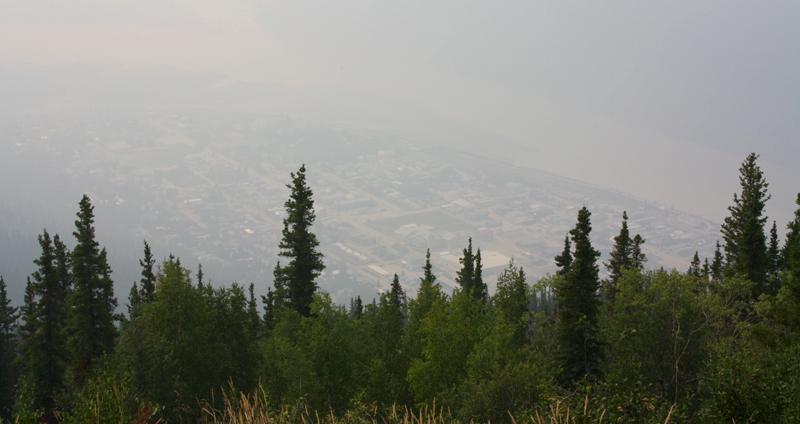 Our view of smoky Dawson from the top of Dome Hill |
In spite of the dusty, smoky conditions, Dawson City was a great stop, a lot of history, and fun to explore. The conditions are all part of experiencing the real last frontier. But, you can have the dust, smoke, and rough roads; I am tired of experiencing it!
Day 61 (Friday, August 7)
Today we drove from Dawson to Whitehorse. Once again Dawson was smoky, dusty, and eerie. The morning drive had no views of mountains or valleys and was just dreary. By the time we broke for lunch, we were starting to emerge from the smoke. The afternoon drive was much improved. It was still a little hazy from smoke but considerably better than the past week.
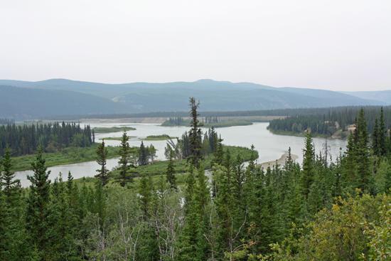 Our lunchtime view on the drive to Whitehorse as we finally start to get out of the smoke |
Day 62 (Saturday, August 8)
Laundry, cleaning, and shopping day. After the drive through the Top of the World Highway and all the dust and smoke, the inside of the trailer needed a lot of cleaning. The outside will have to wait for another day. And there were the needed RV repairs, don't ask. Let's say it isn't a good idea to drive over a low stump hidden in the brush when pulling out of a dirt driveway.