A New Journey
We began a new journey after months of planning, the day finally arrived! The car was packed, the playlist was ready, and the open road was calling. We set off for our 21-day road trip through the stunning and unique landscapes of the Pacific Northwest.
Folsom, CA to Medford, OR - From Golden Hills to Craggy Peaks
We kicked off our adventure with a bright and early start in Folsom. After a final check of our packed car and one last goodbye to our
Folsom home (and double-checking the doors), we hit the road, filled with excitement and anticipation for the journey ahead.
The drive was smooth, with the golden hills of California gradually giving way to the rugged terrain of Northern California and Oregon.
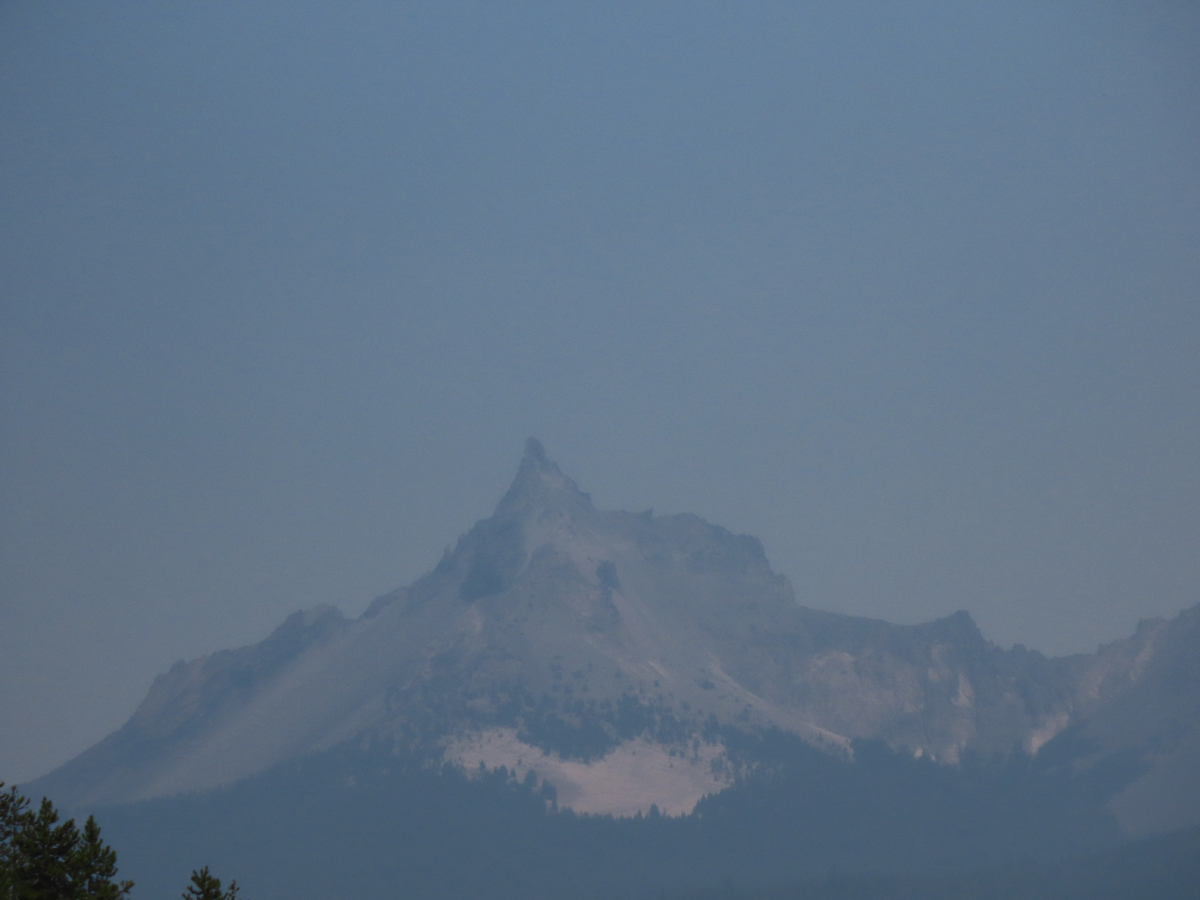
Around midday, we reached our first sightseeing stop: Castle Crags State Park. We first took the uphill one-lane rugged road (with two-way traffic)
to a half-mile hike up to the lookout. From the top, we were rewarded with a breathtaking view of the crags towering above us and a stunning distant
view of Mount Shasta, standing majestically against the horizon. We then drove back downhill to an empty camp spot
and sat out and ate our lunch before continuing our trip north. This was a perfect way to break up the day's drive.
We arrived in Medford in the late afternoon, refreshed from our stop at Castle Crags. We checked into our hotel, SpringHill Suites Medford,
where we stayed for 3 nights. After getting settled, we headed out for dinner at Common Block Brewing Company,
a local establishment that met our culinary taste bud needs. Then we rested up for the next day's adventures, exploring
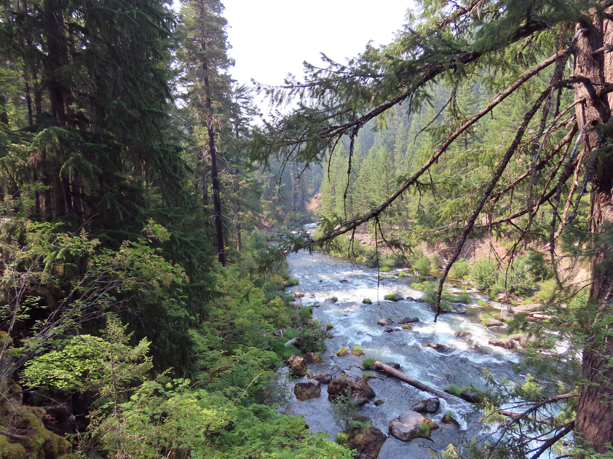
Rogue-Umpqua National Scenic Byway.
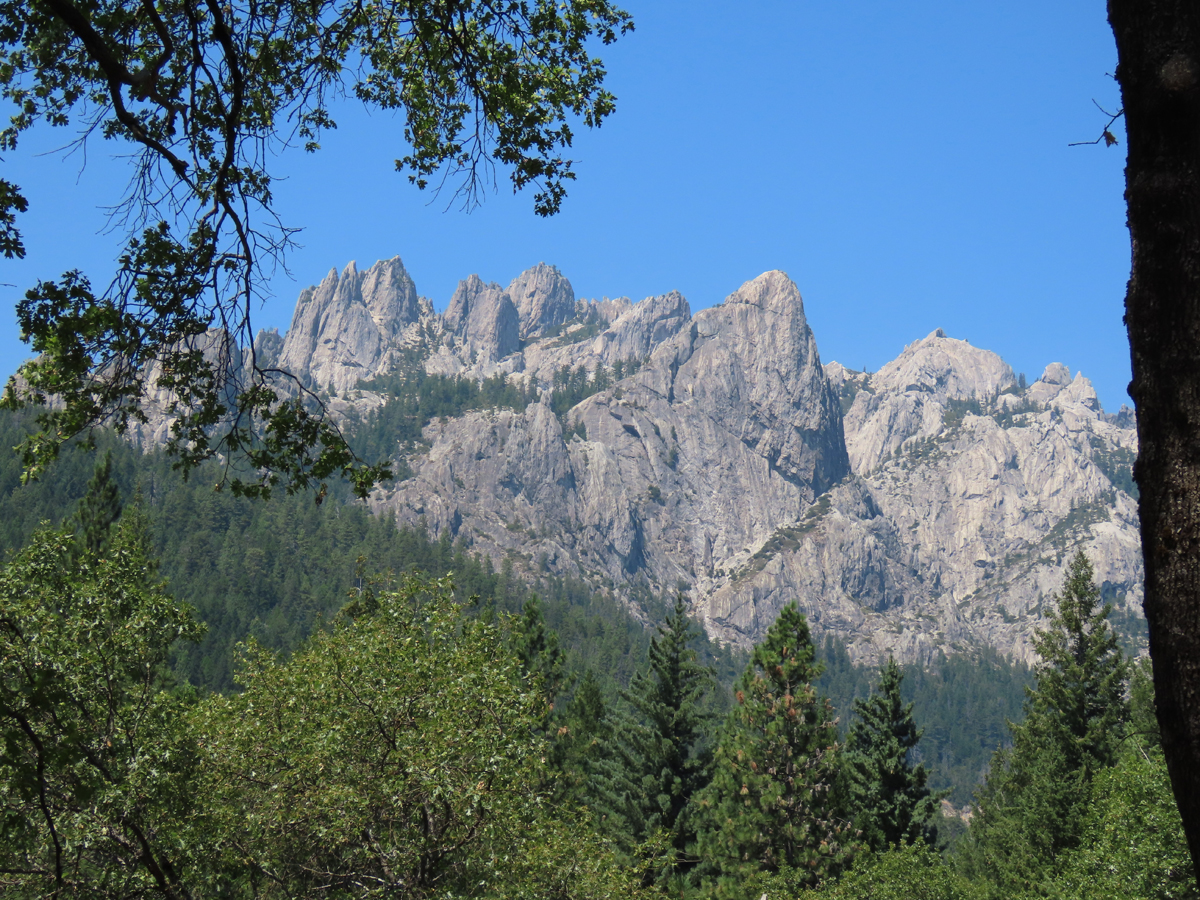 Castle Crags |
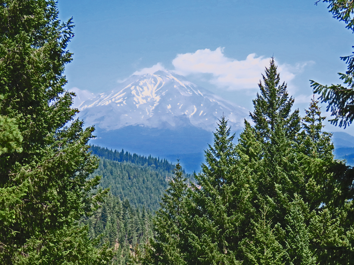 Mount Shasta |
Rogue-Umpqua National Scenic Byway: A Journey Through Nature's Masterpiece
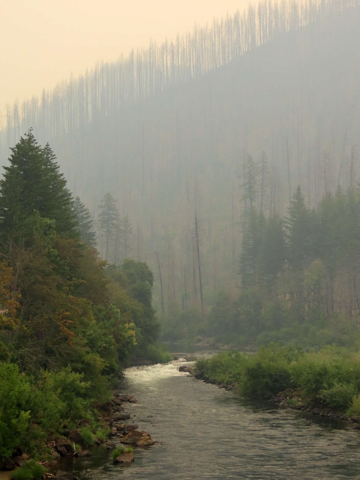
Well… things don’t always go as planned. We set out for Roseburg, eager to embark on the 172-mile scenic drive along
the Rogue-Umpqua National Scenic Byway. However, not long into our journey, the air grew thick with smoke,
and all of the usual stops were closed off with signs warning of "Fire Activity." Determined to make the best of the situation, we stuck to the main
highway and drove back to Medford through the smoky haze.
Despite the detours, the drive was still fascinating in its own way. We passed two enormous fire camps, each one teeming with rows of 1-2 man tents,
a stark reminder of the scale of the firefighting efforts in the area. It wasn’t until the following day, during our visit to Crater Lake,
that we truly grasped the extent of the fires we had driven past. The experience was a sobering contrast to the natural beauty we had been anticipating,
but it also added a unique layer to our adventure.
Rogue-Umpqua National Scenic Byway A-blaze!
|
 ...and the apocalypse was upon us |
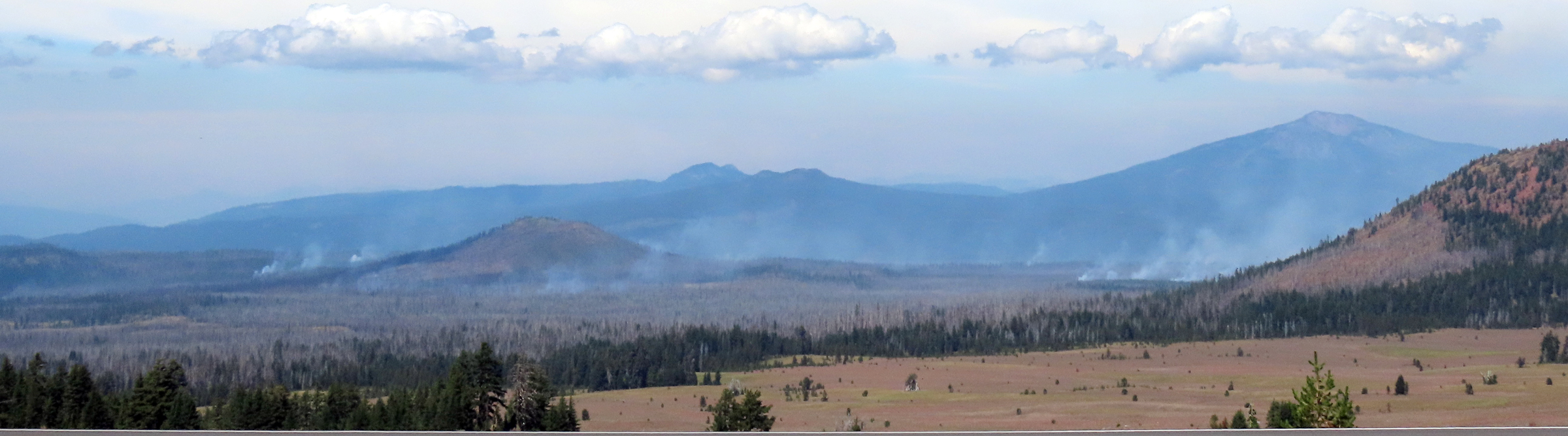 View of the Rogue-Umpqua National Scenic Byway from Crater Lake |
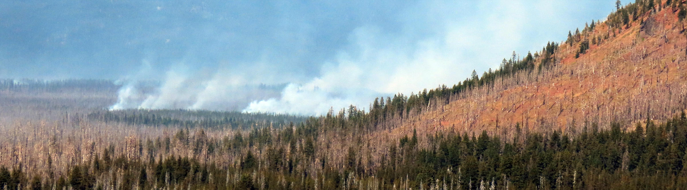 Oregon is burning: fire fighters are fighting numerous fires |
Our Return to Crater Lake!
Early Morning Departure from Medford: We hit the road for our day trip to Crater Lake National Park.
Arriving at Crater Lake, we headed straight to the Steel Visitor Center to get our bearings and learn a bit about the park.
History and facts: Crater Lake, nestled in the Cascade Mountains of southern Oregon, is the deepest lake in
the United States and one of the clearest bodies of water in the world. It was formed over 7,700 years ago after Mount Mazama blew its top.
The caldera gradually filled with rain and snowmelt, creating the stunning blue lake of today. The lake is about 1,943 feet deep
and has no inlets or outlets, which contributes to its clarity and deep blue color. Crater Lake National Park, established in 1902,
offers several viewpoints along its scenic drive.
Rim Drive: We took the Rim Drive, stopping at various viewpoints to enjoy the rich blue color of the lake, its peaceful beauty, and its surrounding cliffs.
Lunch with a View: As we did over ten years ago, we had a picnic lunch at one of the overlooks, with a panoramic view of the lake.
We relaxed and spent some time there just soaking in the beauty, the peace, and the incredible color of the water.
Again, Crater Lake was everything we remembered and more - a day of natural beauty that we will continue to be grateful for.
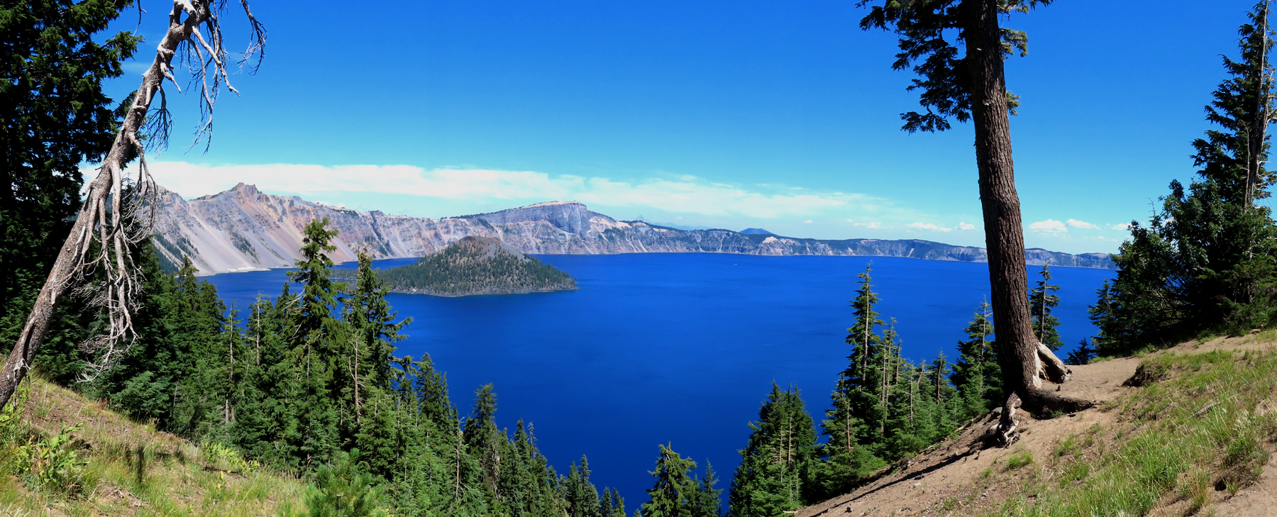 Crater Lake a Majestic View from the Southern End of the Lake |
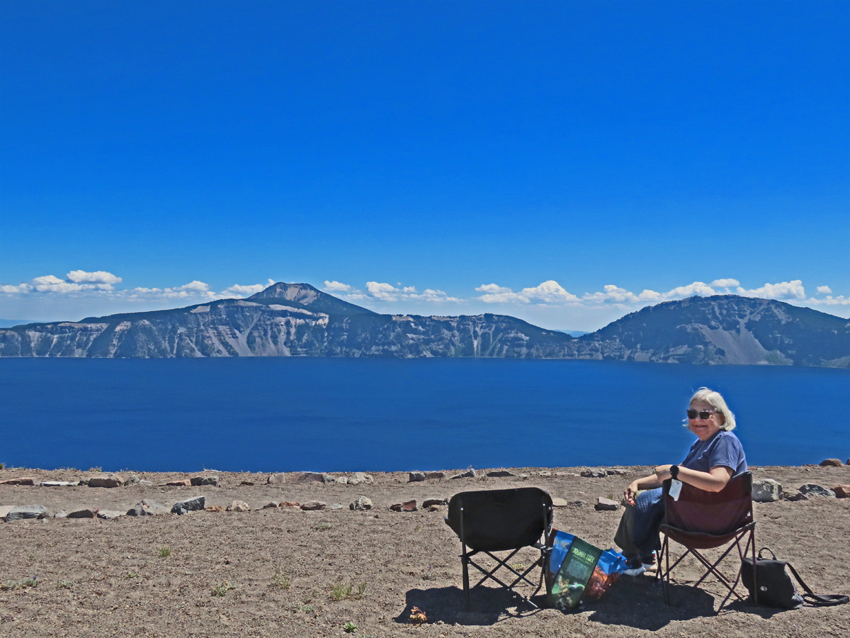 Lunch at the Lake and Peaceful Rest |
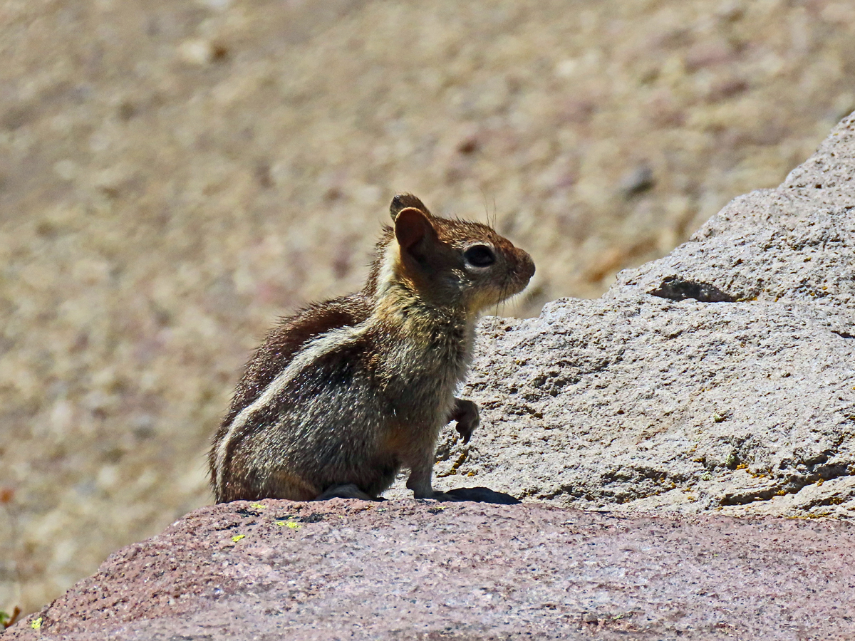 A Little Friend Joined Us for the View |
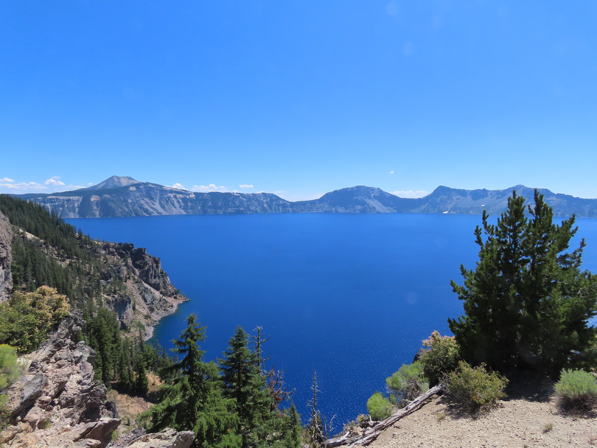 From the Northern End, Still a Gorgeous View |
Columbia River Gorge
Our ride on the Waterfall Trolley along the Oregon side of the Columbia River was a bit underwhelming,
but still a pleasant experience. The trolley is a hop-on-hop-off service with 10 stops, primarily highlighting waterfalls
on the inland side of the road. Unfortunately, the stops were too brief, just long enough for a quick drop-off and pick-up,
leaving no time to get off and and take a snap photo before the trolley moved on. If you decide to get off,
you have to wait an hour for the next trolley.
Years ago, we took an RV trip where we drove along a section of the Columbia River. That section was more like a canyon,
with steep banks lining the road. That route must have been further inland. On this trip, we decided to hop off the trolley
at Multnomah Falls & Lodge for an hour. The falls were beautiful, though we found them less impressive than some of the grander
waterfalls we've visited in other national parks.
In the afternoon, we made our way to the Fort Vancouver National Historic Site. Built by the Hudson's Bay Company in 1825,
this fort was once a key hub for trade in the Pacific Northwest.
We wrapped up the day with a relaxed dinner at McMenamins on the Columbia, enjoying our meal on the patio
while watching the river's calm activity.
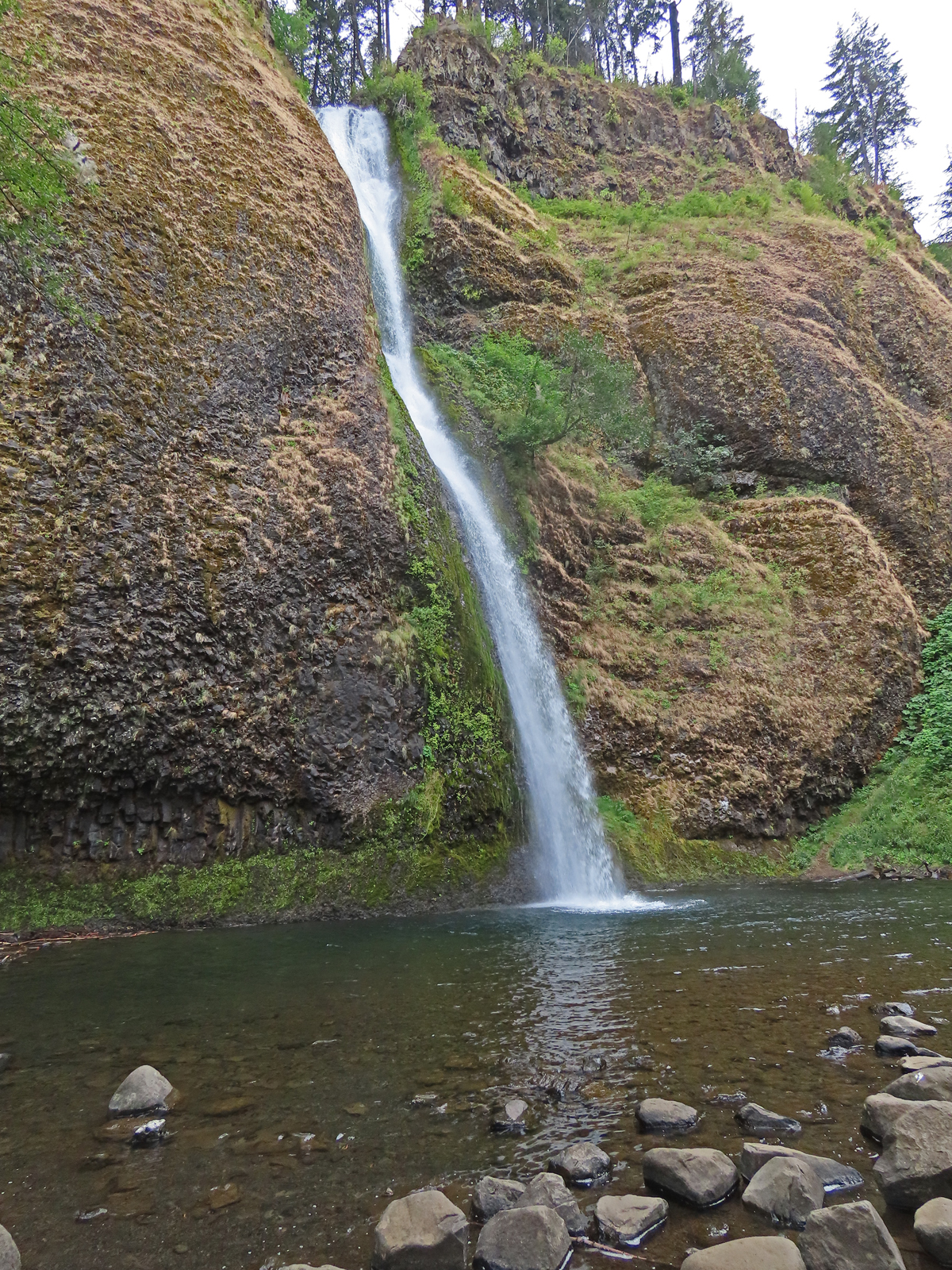 Horsetail Falls |
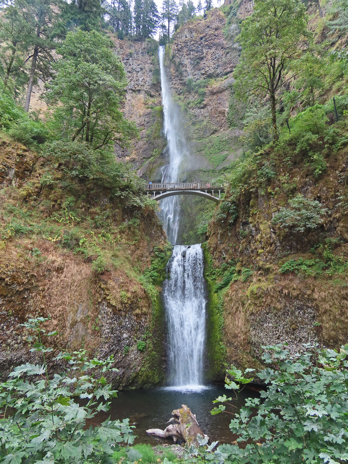 Multnomah Falls |
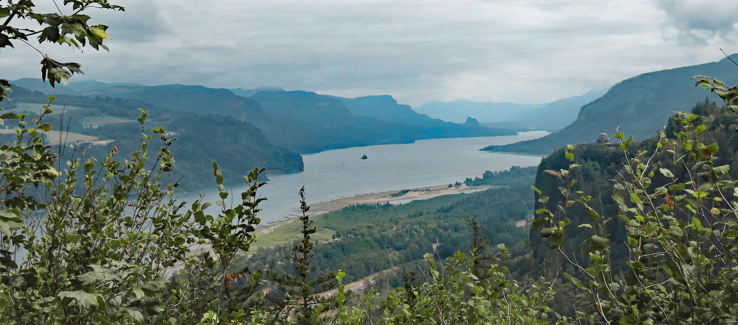 The Columbia River |
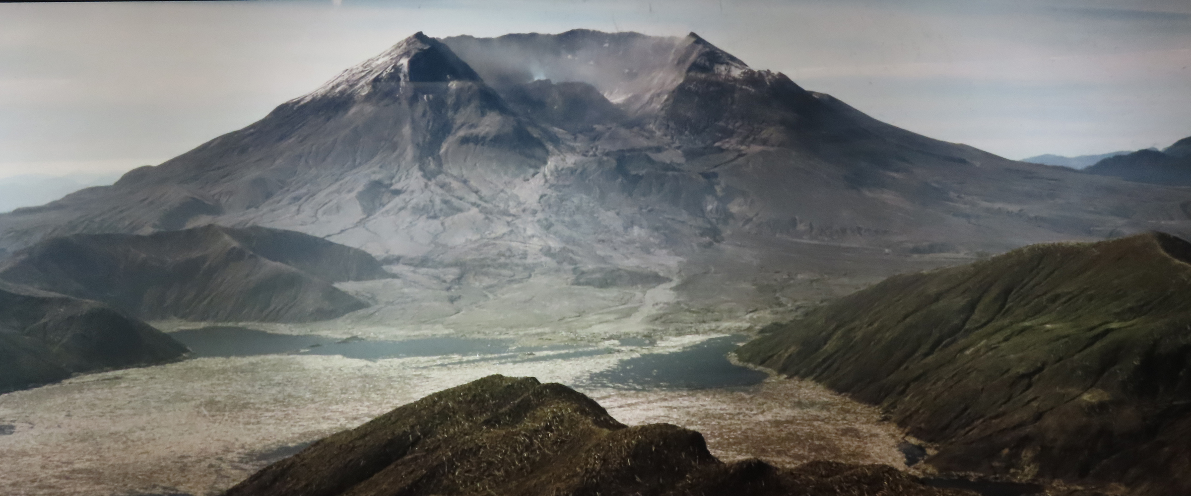
Mount St. Helens: Nature's Power and Renewal
Our journey next led us to the awe-inspiring site of Mount St. Helens. We took the scenic route up Highway 504,
which winds through the landscape forever changed by the volcano's infamous 1980 eruption. Unfortunately, a landslide
in May 2023 meant that Highway 504 was closed at mile marker 44, preventing us from reaching the
Johnston Ridge Observatory. Despite this, the Science and Learning Center at mile marker 43 offered a
fantastic vantage point, allowing us to take in the expansive views.
Our adventure began just a few miles from I-5 at the Mount St. Helens Visitor Center at Silver Lake. The exhibits,
along with an engaging 22-minute film, gave us a vivid picture of the eruption’s impact on the region
and the ongoing recovery efforts that have reshaped the landscape over the years.
From the Visitor Center, we continued our drive along Highway 504, taking in the dramatic terrain that the eruption
had carved out. When we reached the Science and Learning Center, we were greeted by sweeping views of the vast
lava plains and the regrowing forests.
Our anticipation built as we ascended Highway 504, eager for that breathtaking
panoramic view of Mount St. Helens…
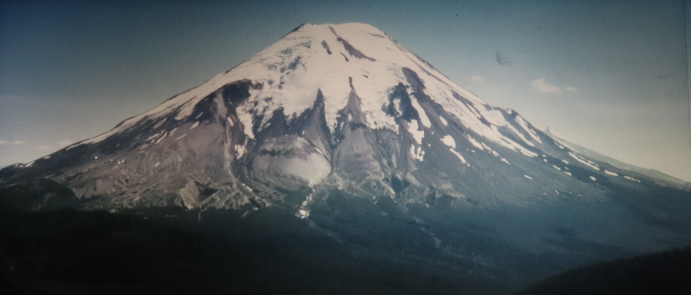 The Mountain Before the Eruption (picture of a picture) |
|
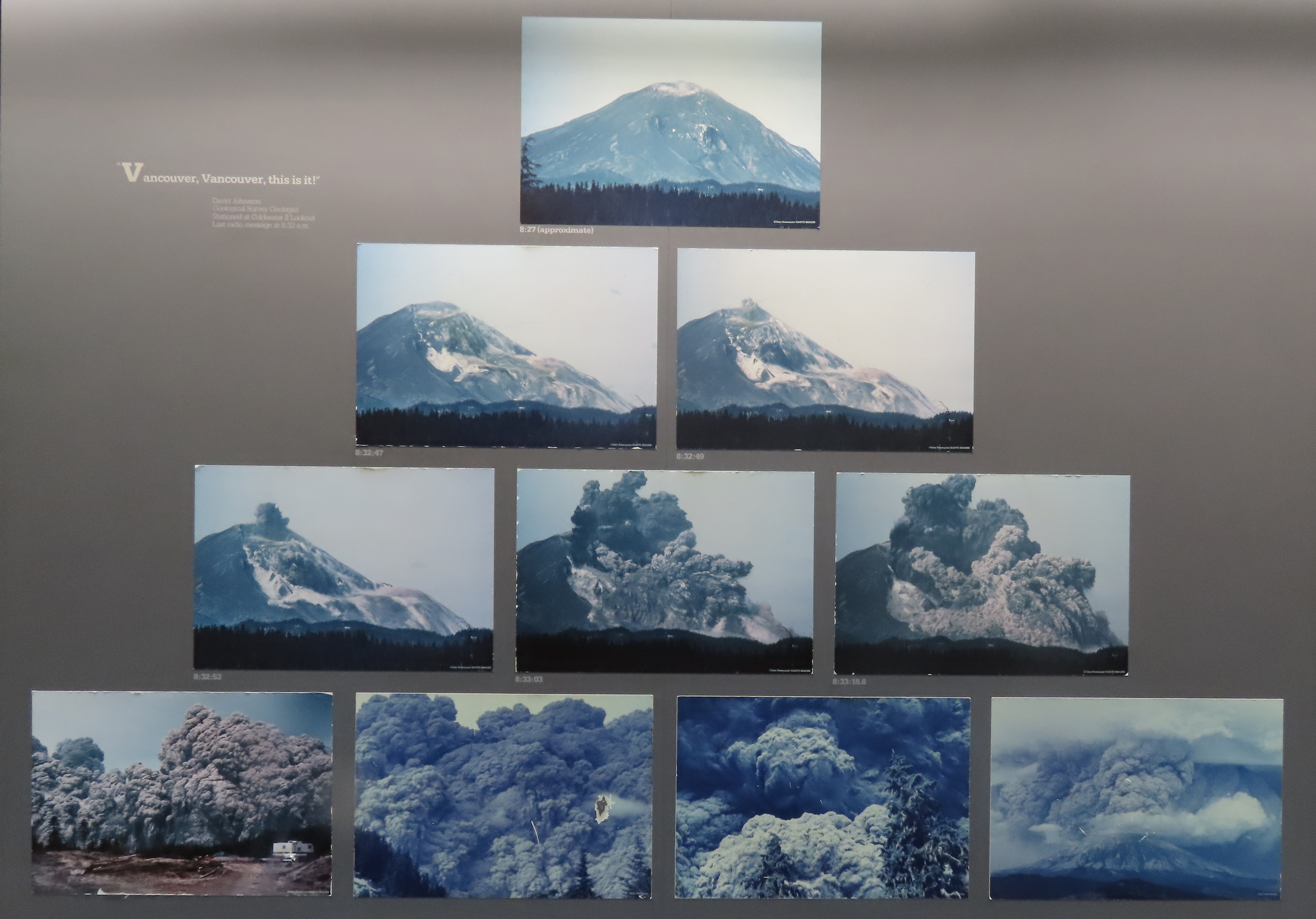 The Eruption (picture of a picture) |
|
 The Mountain After the Eruption (picture of a picture) |
|
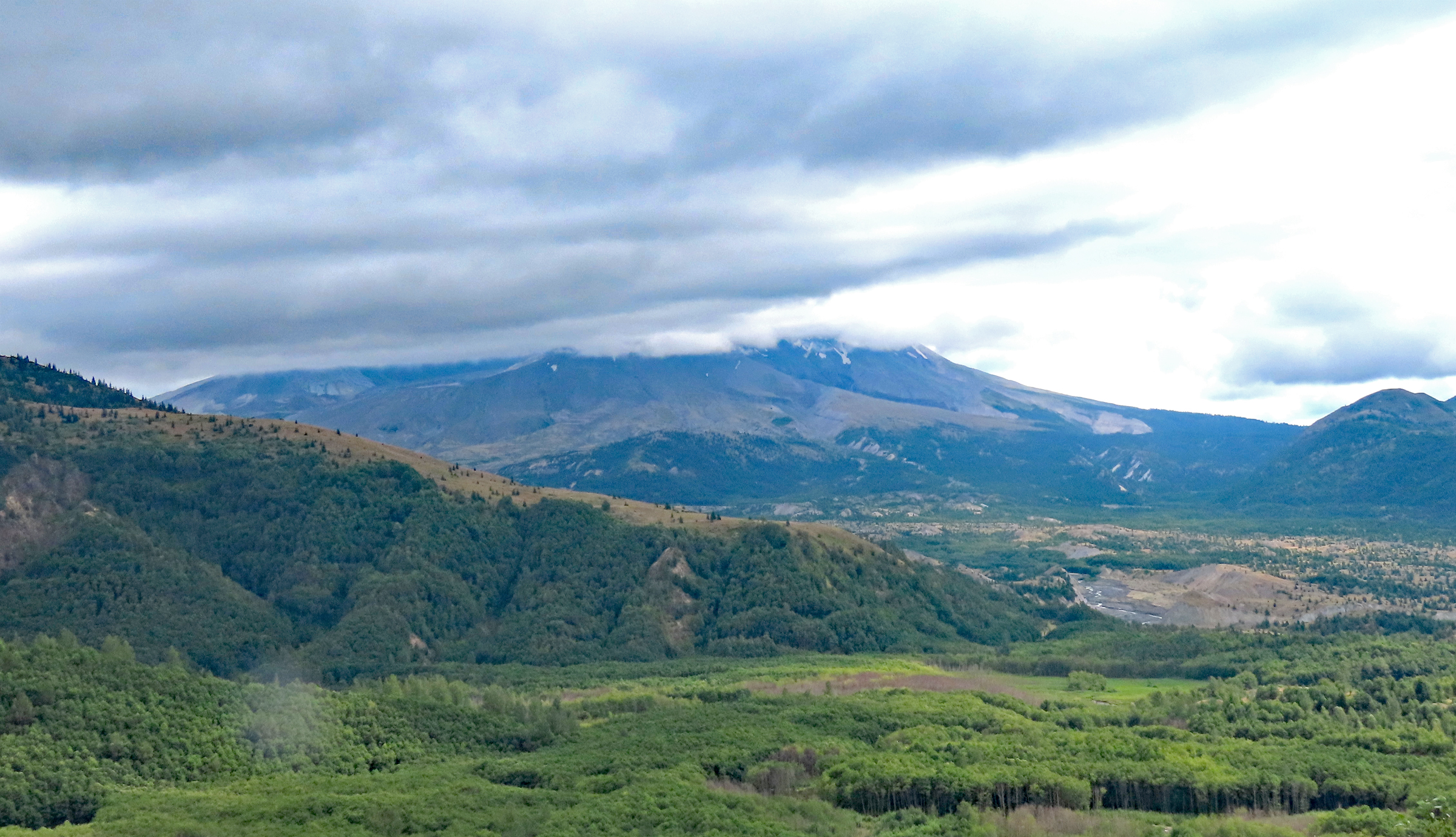 The View at the End of Our Drive (darn clouds got in our way!!!) |