Becky's Journal - Alaska Highway Part 2, June 21 - June 27
Alaska Highway:
Teslin
Monday, June 22, 2009
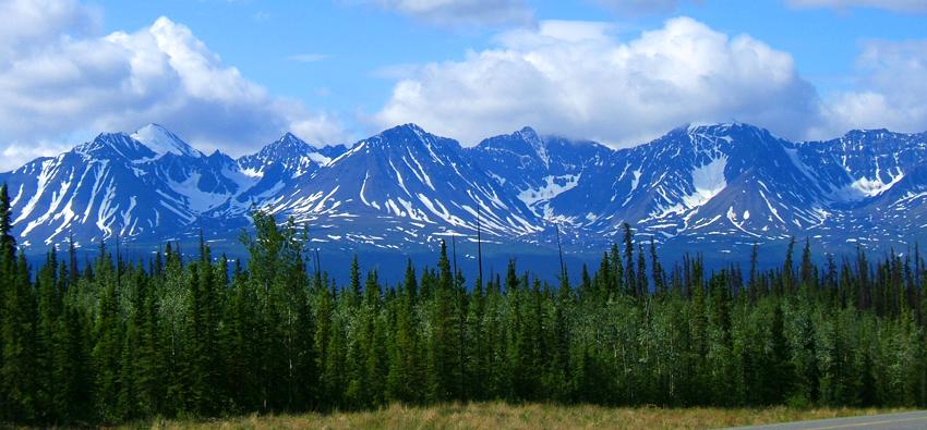
Saying good-bye to Watson Lake on a drizzly morning, we headed 168 miles further up the road to Teslin. The verdant greenbelt verge disappeared, replaced by a scrub growth dotted with bare ground, scruffy grass, wildflowers and an occasional small tree; our wildlife viewing was nonexistent on this leg of the trip. Despite rain and bitter wind, the scenic views of snow-capped Cassiar Mountains were spectacular.
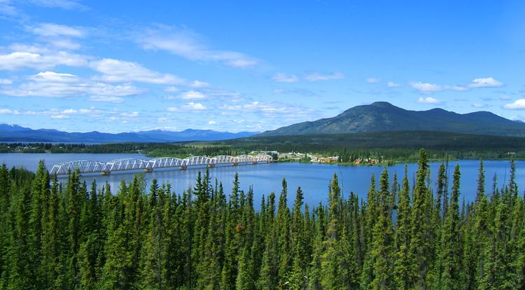
Descending into Teslin, on the shores of Teslin Lake, the views were an unexpected surprise. (That’s our RV park to the left of the bridge in the photo below.)
Late afternoon, we walked through a small wildlife museum on the grounds of the RV park and then visited the George Johnston Museum. Johnston (1884-1972) was a Tlingit Indian who chronicled his people and his early twentieth-century life through photography. An area trapper, Johnston brought the first automobile to Teslin despite the lack of roads. In winter, he painted his vehicle white to camouflage it from animals when hunting. He utilized the 80 miles of frozen lake in season and enlisted help in building a four-mile road over which he operated a “taxi” service. This short road was later incorporated into the Alaska Highway.
Alaska
Highway: Whitehorse
Tuesday, June 23, 2009
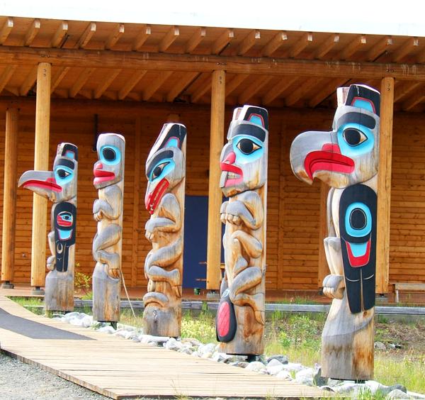
As we left Teslin, we stopped at The Teslin Tlingit Heritage Centre, with its exhibits illustrating the history and the culture of the Inland Tlingit people. Their collection includes totems, colorful carved masks and dugout canoes – all decorated in bright red and turquoise.
Our drive today was short – only 110 miles – but we were treated to mountain views and a surprise fox by the side of the road.
After setting up at the Caribou RV Park, where we plan to spend three nights, we drove into Whitehorse to get the lay of the land. The provincial capital and largest city in the Yukon Territory, Whitehorse is a bustling city of 25,000 on the Yukon River.
Wednesday, June 24, 2009
The day was devoted to life’s necessities – cleaning, laundry, fixing things and shopping, but we got a chance to “play” in the evening. After a tasty pizza at Boston Pizza, a chain we have seen quite a bit on our journey, we attended Frantic Follies, a vaudevillian revue of the 1898 Klondike gold rush era. (See photos in Tom’s Journal.) Surprisingly good, the show featured cancan dancers, singers, banjo players, and skits – much of it based around the poetry of Robert Service, who immortalized that era in verse like “The Cremation of Sam McGee” and "The Shooting of Dan McGrew."
Thursday, June 25, 2009
After a few more errands, we set out to explore Whitehorse. Our first stop was the SS Klondike, a paddle wheeler that carried passengers and cargo up and down the Yukon River in the early 1930s, until she ran aground in 1936. Rebuilt, the Klondike II traveled the 246 miles from Whitehorse and Dawson City until her retirement in 1955. Tom and I took a tour of the ship, which was quite interesting. After a picnic lunch on the grounds of the Klondike National Historic Site, our second stop was the McBride Museum where we learned much about Yukon’s history and colorful characters, and its gold and copper industries. We also stopped at the Old Log Cabin Museum, built in 1900, now a tribute to some of the early Anglican missionaries who ventured into this area long before the gold seekers and adventurers. On the way back to the trailer, we stopped to take some photos of the Douglas DC-3 that became the world’s largest weather vane in 1981.

Alaska
Highway: Destruction Bay
Friday, June 26, 2009
Not much in the way of wildlife sightings today unless you want to count chipmunks and open-range horses, but the snow-covered mountain views were spectacular. We got our first looks at the majestic Kluane Icefield Ranges, the outer portion of the St. Elias Mountains and the Auriol Range.
Tonight we are camped at Destruction Bay on windy Kluane Lake, the largest lake in the Yukon Territory. Tomorrow, we head to Alaska, back to the USA for a while.
Alaska
Highway: Delta Junction
Saturday, June 27, 2009
We made it!
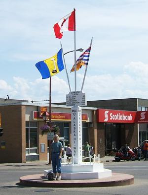
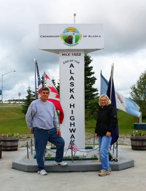
1422 miles on the Alaska Highway from Dawson Creek to Delta Junction. For now, we are back in the USA, heading Monday to the civilization of Fairbanks. After getting the lay of the town, we got our Alaska Highway completion certificate and celebrated with burgers at Buffalo Center Diner. Tomorrow, after church, we will have to explore the sights of Delta Junction.
Awakening this morning in Destruction Bay, many of the surrounding mountains were shrouded in clouds. Although our drive today boasted many spectacular mountain views, the tops were blanketed in clouds.
We rose early, expecting to be slowed by construction today, as this segment of the road is notoriously rough with potholes and frost heaves due to the harshness of winter. We were pleasantly surprised that the construction workers took Saturday off, so we weren’t held up by them – only slowed a bit by gravel sections and poor roads. This segment of road is especially bad because it is built over permafrost where the ground is permanently frozen. Building a road or scraping off the top layer of soil heats up the ground so that it melts and turns to mush, causing the cracks, breaks, and heaves in the pavement.
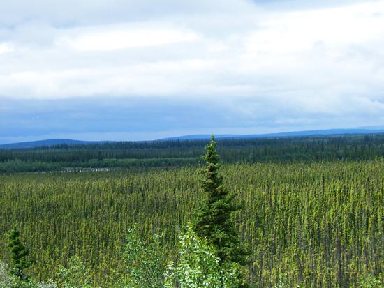
Sections beside the road today were often missing the lush forests we had gotten used to. Instead, many areas had what looked like stunted trees. Again the culprit was permafrost, which blocks drainage and limits root growth and soil fertility. The areas, called taiga or “land of little sticks” in Russian (a perfect description) are populated by slow-growing black spruce that thrive where few other plants can.
The wildlife seemed to take the day off, too. We spotted a pair of swans on a lake as we passed, but, otherwise, we only saw a few squirrels and domesticated animals.
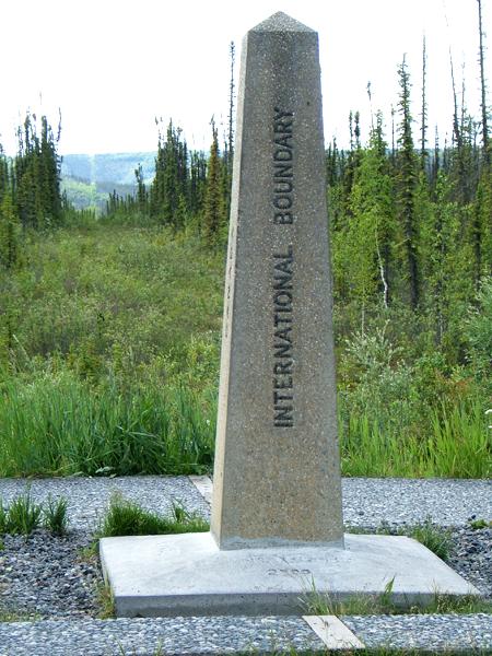
Around noon, we reached the international border – a celebratory picture spot for most of the tourists heading north. Of interest to me, surveyors have cut a 20-foot swath at the actual border, which is periodically cleared by the International Border Commission.
On to Fairbanks Monday for several days of sightseeing and relaxing.