Becky's Journal - August 16 - August 26
Heading Home
Cassiar Highway to Waterton Lakes National Park
Including Hyder-Stewart, Jasper, Banff, and Waterton Lakes Parks
Iskut to Stewart – Sunday, August 16, 2009
The southern end of the Cassiar Highway, so far, is
much improved over our bumpy ride yesterday.
We passed through sparsely forested rolling hills and higher,
majestic mountains, along with rivers, ponds, and streams.
The bonus was seeing a moose next to the road.
We caught up to and again played tag with an RV caravan we’ve
been shadowing (or vice versa) since Skagway.
Shortly after lunch, we turned west on a spur road
over to the coastal town of Stewart, B.C.
Despite overcast skies, we had reasonably clear views of the
hanging glaciers above, including Bear Glacier.
We followed a steep-sided narrow
canyon along the Bear River to our RV Park in Stewart, BC.
Stewart and its sister city Hyder, AK are at the head of a fjord
on the Portland Canal, a setting similar to Skagway (and Valdez).
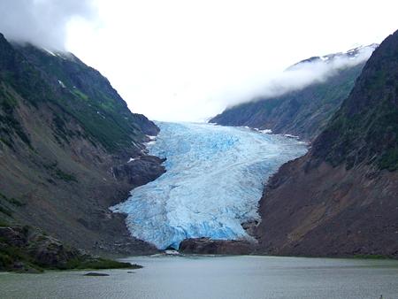 Bear Glacier on the Glacier Highway |
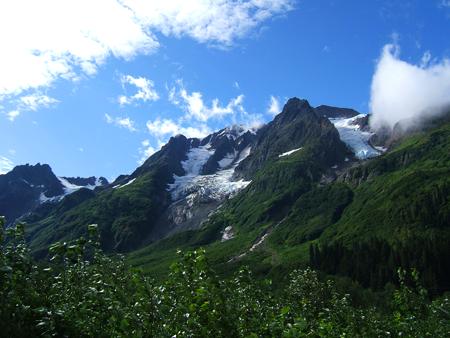 Hanging glaciers on the road to Stewart and Hyder |
Hyder Bears – Monday, August 17, 2009
This morning we crossed back into
Alaska to Hyder, an isolated town on the decline.
Both Stewart and Hyder began as mining ventures by prospectors
hoping to avoid the long, arduous trek to the Klondike.
Corporate mining success with copper, silver, and gold continued
into the mid-1900s, and some exploration continues today.
However, both Stewart (with a population of about 500) and Hyder
(population 100) seem to be dying – with many businesses and homes
either vacant or boarded up, or for sale.
Our purpose in going to Hyder was not to mine or
stimulate the economy (although I did purchase a souvenir pin); our
purpose was to see bears. This is bear
country, and the
USFS Fish Creek Wildlife Observation Site provides a safe way for
people to observe Alaskan Brown (grizzly) and Black bears – from a
raised boardwalk platform.
We weren’t sure what success we would have, as many people (hardcore
photographers) “camp” at the boardwalk waiting for the bears.
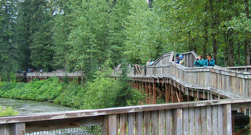 Bear watchers waiting on the boardwalk at Fish Creek |
During the season, a dozen bears have frequented the
creek to catch spawning salmon, but this late in the season about four
bears still steadily appear.
Joining the hopeful crowd in the drizzling rain, we waited.
After about 15 minutes, a male bear was sighted downstream, but
he didn’t venture up close to us.
The group of tourists and photographers returned to the waiting
game. I looked up, and saw a
bear making its way downstream to our position.
I feverishly began snapping photos of Monica (the rangers have
them all named and identified), a 15-or-16-year old “mother of many.”
She wasn’t at all fazed by the onlookers as she slowly made her
way downstream fishing and nosing the salmon.
After she later disappeared, Tom and I decided we’d had our bear
sighting (it couldn’t get any better than that), and we moved on.
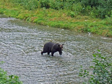 Monica arrives at Fish Creek |
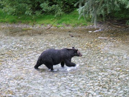 Looking for salmon for a snack |
We continued up the road 20 miles on the scenic Salmon
Glacier self-guided auto tour.
The drizzle became rain, and it rained lightly most of the day.
We passed historic and present mining ventures, as we wound our
way up a rough, rutted dirt road.
The cloudy, rainy, cool weather typical of coastal Alaska
precluded most of our views of the Salmon Glacier, the fifth largest
glacier in Canada.
Stewart to Smithers – Tuesday, August 18, 2009
This morning, the skies were somewhat clearer in
Stewart, but, as we headed back through narrow Bear River Canyon with
its hanging glaciers, it clouded up again and drizzled.
Breaking out of the canyon, the valley was clearer as we reached
the warmer, dry interior.
At the end of the Cassiar Highway, we hit the
TransCanada Highway, a major east-west thoroughfare, and it was smooth
sailing through a mix of forest and agricultural lands to Smithers,
British Columbia. Once we
hit the main east-west highway, it felt like we had returned to
civilization and were, unfortunately, headed home.
(It has been a fantastic summer!)
Many thanks to those of you who sent me e-mail
birthday wishes. Funny, I
never feel any older. Tom
made me pancakes for breakfast, and we had a Rustic Italian Pizza at
Boston Pizza for dinner. Of
course, we had to pick up some ice cream and half a German Chocolate
Cake at Safeway. (We
are back in civilization.)
Smithers to Prince George – Wednesday, August 19,
2009
Today we rolled southeast on the smooth TransCanada
Highway. We traveled through
agricultural, mining, and logging areas dotted with beautiful, serene
lakes and rolling hills. The
sun was shining, and it was over 80 degrees Fahrenheit in Prince George
today. We are camped at Bee
Lazee, the same RV park in which we stayed on our way north in early
June.
Prince George – Thursday, August 20, 2009
I did laundry this morning while Tom cleaned the
trailer. This afternoon, we
went to Save-On grocery and to Costco; we really are back in
civilization.
Prince George to Hinton, Alberta – Friday, August
21, 2009
Yesterday, we decided to spend a little extra time in
Lake Louise, so we tweaked our itinerary.
The TransCanada Highway gave way to thicker forests with mountain
vistas – and finally the Rockies – a bit hazy and smoky.
The road climbed up past Mt. Robson, at almost 13,000 feet, the
highest peak in the Canadian Rockies.
Mid-afternoon, we reached the western entrance to
Jasper National Park. (We
visited Jasper and Banff seven years ago, and many of the names and
sights are familiar.) Today
we stopped for some information at the visitors’ center in the town of
Jasper, but continued across the park to Hinton, its eastern gateway.
As we crossed the park, the wide grassy verge made animal
spotting easy, and we saw a caribou, six or eight bighorn sheep, and an
elk. None seems phased by
the dozens of tourists clicking away.
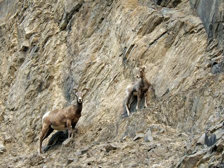 Bighorn Sheep in Jasper National Park |
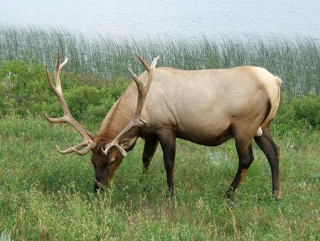 Elk grazes along the road |
Hinton to Lake Louise – Saturday, August 22, 2009
We got an early start for our drive through Jasper
National Park, on the Icefields Parkway to Lake Louise in Banff National
Park. We were treated with
wildlife sightings on the northern edge of the park – a coyote crossed
the road in front of us, a Bighorn Sheep nursery band (does with young),
and a group of four male Bighorns resting down by the river.
The smoky haze from yesterday had dissipated and we saw some
pretty amazing views of glaciers and mountains.
We drove the 230 km parkway in September 2002 from
Lake Louise to Jasper, and both Tom and I remembered some of the sights.
Today we stopped at Athabasca Falls, Sunwapta Falls, and the
Icefield Centre, where seven years ago we rode the Sno-Cat out onto
Athabasca Glacier. Today, we
ate lunch feasting our eyes on the snow and peaks, and wandered through
some of the exhibits.
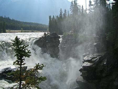 Athabasca Falls |
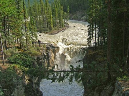 Sunwapta Falls |
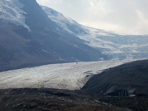 Lunchtime view of Athabasca Glacier |
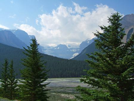 View along the Icefields Parkway |
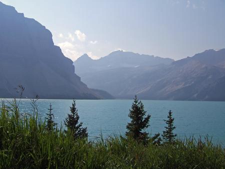 Bow Lake |
We arrived at the Lake Louise Parks Canada campground
late afternoon, settled in, and drove back into town.
I remember a lot about this area from seven years ago.
Although the scenery is gorgeous, I think Tom and I are a bit
spoiled on the heels of the breathe-taking views – of much higher peaks
– in Alaska.
Lake Louise – Sunday, August 23, 2009
To catch the morning light and avoid the crowds, we headed over to Lake Louise early morning. It really is spectacular in the morning light!
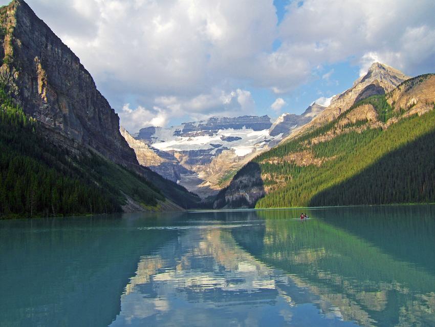
Lake Louise in the Morning
Then we headed out to the Lake Louise Mountain Resort ski area
and sightseeing gondolas – the one thing we didn’t do seven years ago.
The views from the top were pretty spectacular – including a
grizzly bear that closed most of the hiking trails at the top.
We managed to squeeze in a short guided nature walk to learn
about safety in bear country.
After riding the gondola back down, we satisfied our healthy
appetites at a buffet at the lodge.
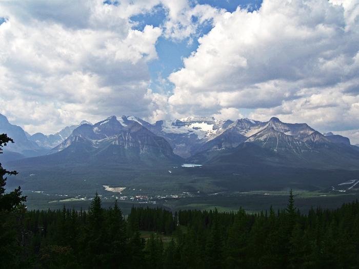 Lake Louise and village seen from gondola heights |
This evening, we headed back over to the lake, where
we had dinner in the dining room of Chateau Lake Louise. To celebrate our 33rd wedding anniversary (which was
Friday), we ate a scrumptious dinner looking out over the beautiful lake
view.
Lake Louise to Waterton Lakes – Monday, August 24,
2009
Today we headed east on the TransCanada Highway, but
soon we turned south through rolling green hills – rich, green ranchland
and farmland. After a stop
in Canmore and a lunch break in Millarville, we arrived in Waterton
Townsite Campground late afternoon.
Dozens of deer were there to greet us.
They graze all over the campground and don’t spook too easily.
Tom had a difficult time getting a couple to “shoo,” so we could
set up the trailer. Mission
accomplished, we headed over to the visitors’ center before fixing
dinner.
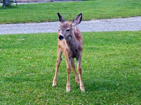 Welcome to Townsite Campground |
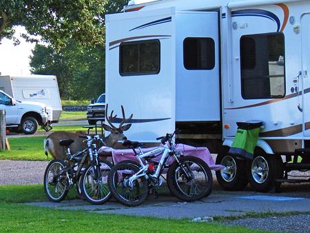 Hmmm...Which bike should I ride today? |
Waterton Lakes – Tuesday,
August 25, 2009
Waterton Lakes National Park, where the prairie abruptly meets the lower foothills of the Canadian Rockies, is over the border from Glacier National Park. There are three scenic, aqua blue lakes – named Lower Waterton Lake, Middle Waterton Lake, and Upper Waterton Lake – plus a picturesque area for relaxing, hiking, and boating.
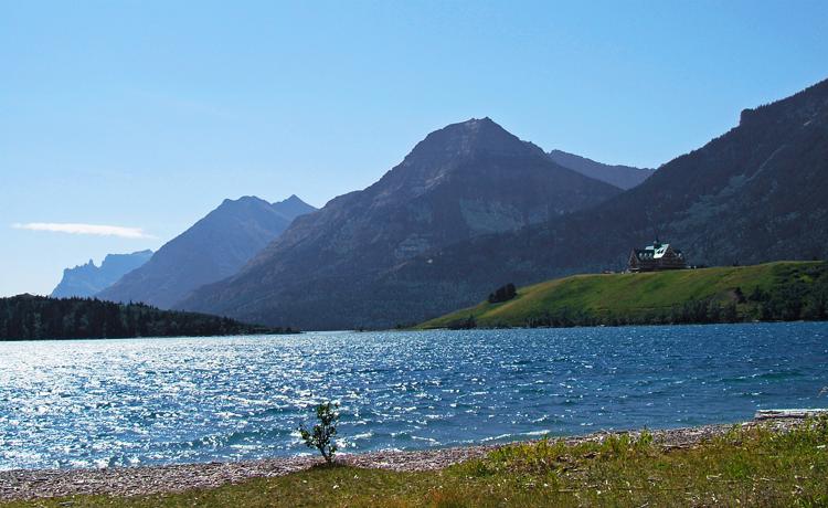 Middle Waterton Lake sparkles in the sunshine |
This morning we drove the 15 km Red Rock Parkway, one of two scenic drives in the park. Along the way, I kept wondering why it was so named. Parking at the end of the road, when we stopped to hike up to Blakiston Falls, I was still wondering. But as we crossed the first bridge, I finally saw Red Rock Canyon – much smaller than I would have thought.
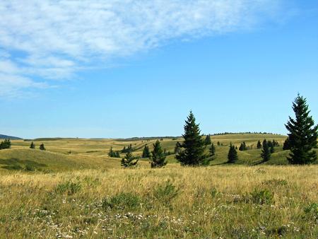 Alberta prairie meets... |
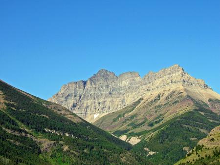 Rocky Mountain foothills |
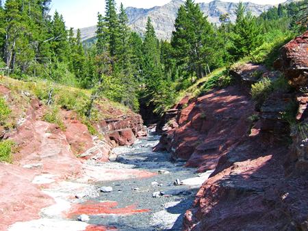 Red Rock Canyon |
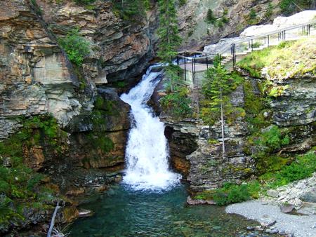 Blakiston Falls |
After a picnic lunch, we drove out to the bison paddock to see a small bison herd on the prairie. On the way back into town, we wandered about the town site, with its summer resort ambiance.
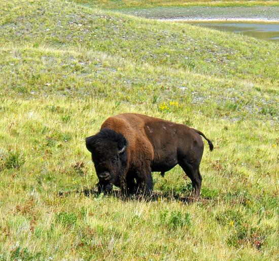 Bison...home on the prairie |
Waterton Lakes – Wednesday,
August 26, 2009
Slightly windier and cloudier than yesterday, but another nice day to explore the park. The deer were absent from the campground this morning, but they have returned this evening.
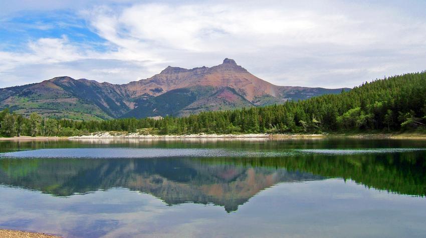 Hike destination: Crandell Lake |
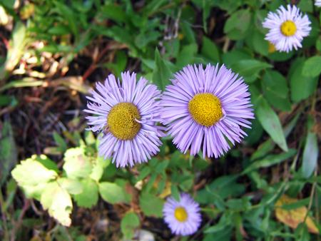
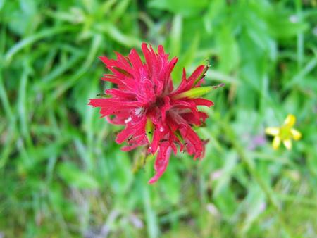
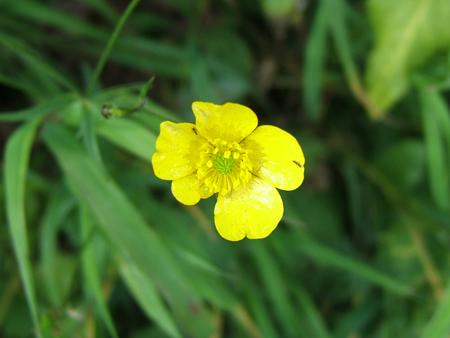
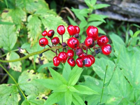
After breakfast, we headed out the Akamina Parkway, the second scenic drive in Waterton Lakes National Park. Along the way, we stopped to hike the 2.4 km. trail roundtrip to Crandell Lake, a pristine mountain lake nestled in the midst of thick woods. It was an uphill-downhill trek, through forests and meadows filled with beautiful wildflowers and berries. The isolation (we didn’t meet anyone on the trail) and silence (except for birds) were refreshing.
 |
 |
 |
 |
After our hike, we continued out the Akamina Parkway to Cameron Lake for a picnic. This day-use area was much more popular with tourists and those renting kayaks and paddle boats.
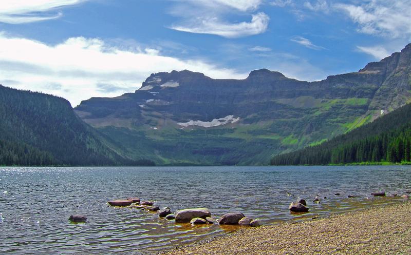 Picnic view: Cameron Lake |
On the way back to the trailer, we drove up to the Prince of Wales Hotel, a testimony to an older, refined time. Balanced on the top of a hill – and visible from much of the park – the views of Waterton Lakes from here were beautiful.
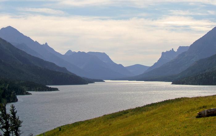 Goodbye Waterton Lakes: View from the Prince of Wales hotel |
Final Thoughts
As we leave tomorrow, we are headed home – through Idaho and Oregon – returning to the United States and even more civilization. This has been quite an adventure – an overview of our 49th state. We have learned and experienced much. It has been wonderful.